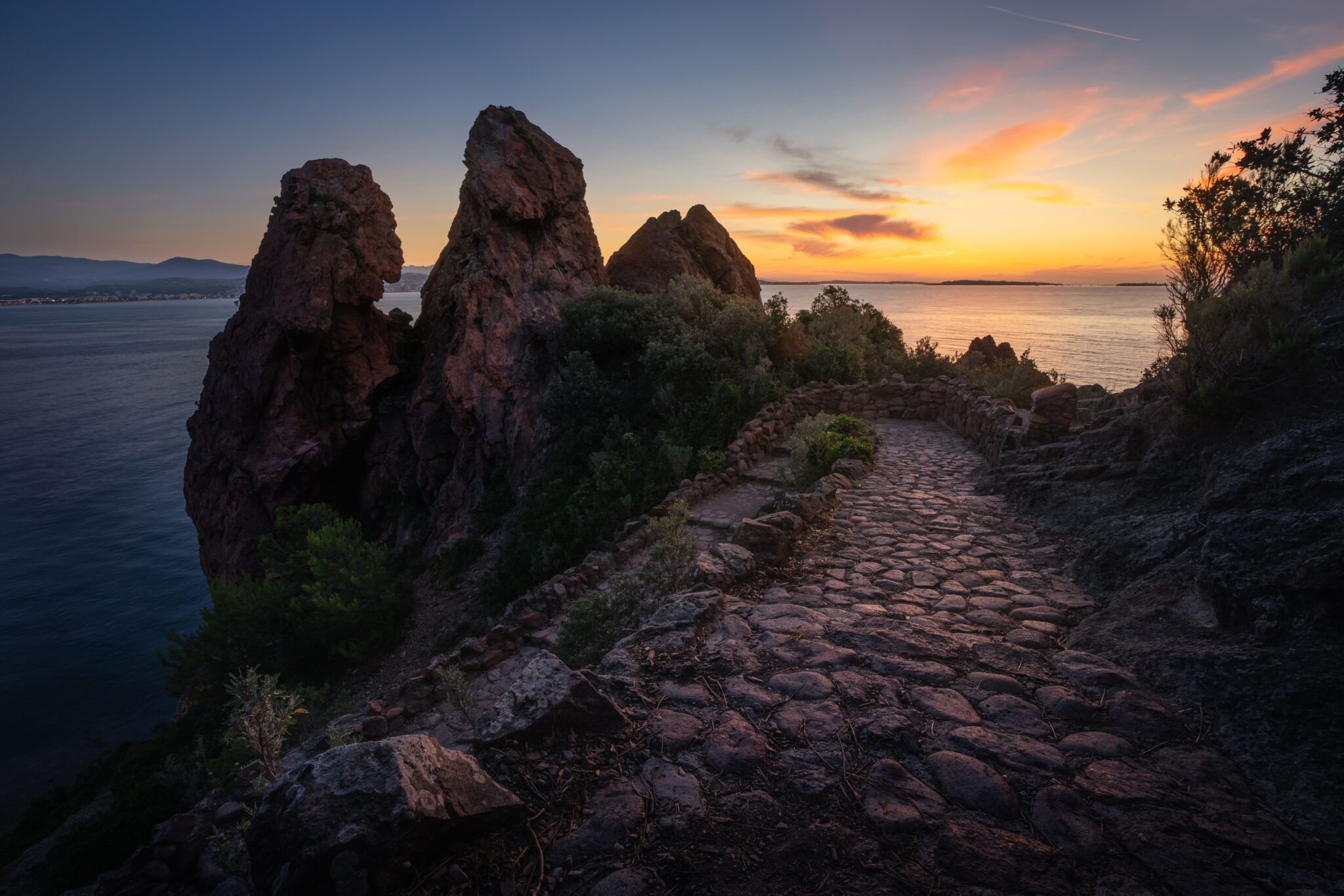
We visit the cutest inhabitants of the Faroe Islands, take a look at a few more unknown spots that are super easy to reach, a moderately difficult hike with a great view of Klakkur, drive through Klaksvík and hike to two of the absolute highlights of the Faroe Islands. At the end of this series, I would also like to write about a few things you should know before you go hiking on the Faroe Islands!
You can see the VLOG to the BLOG at the bottom of the page or you can reach it via this button:
Gear:
Sony a7IV
Sony FE 2.8/16–35 mm GM
Sony FE 4/24–105 mm G
Sony FE 100–400 mm GM
DJI Mini 3 Pro
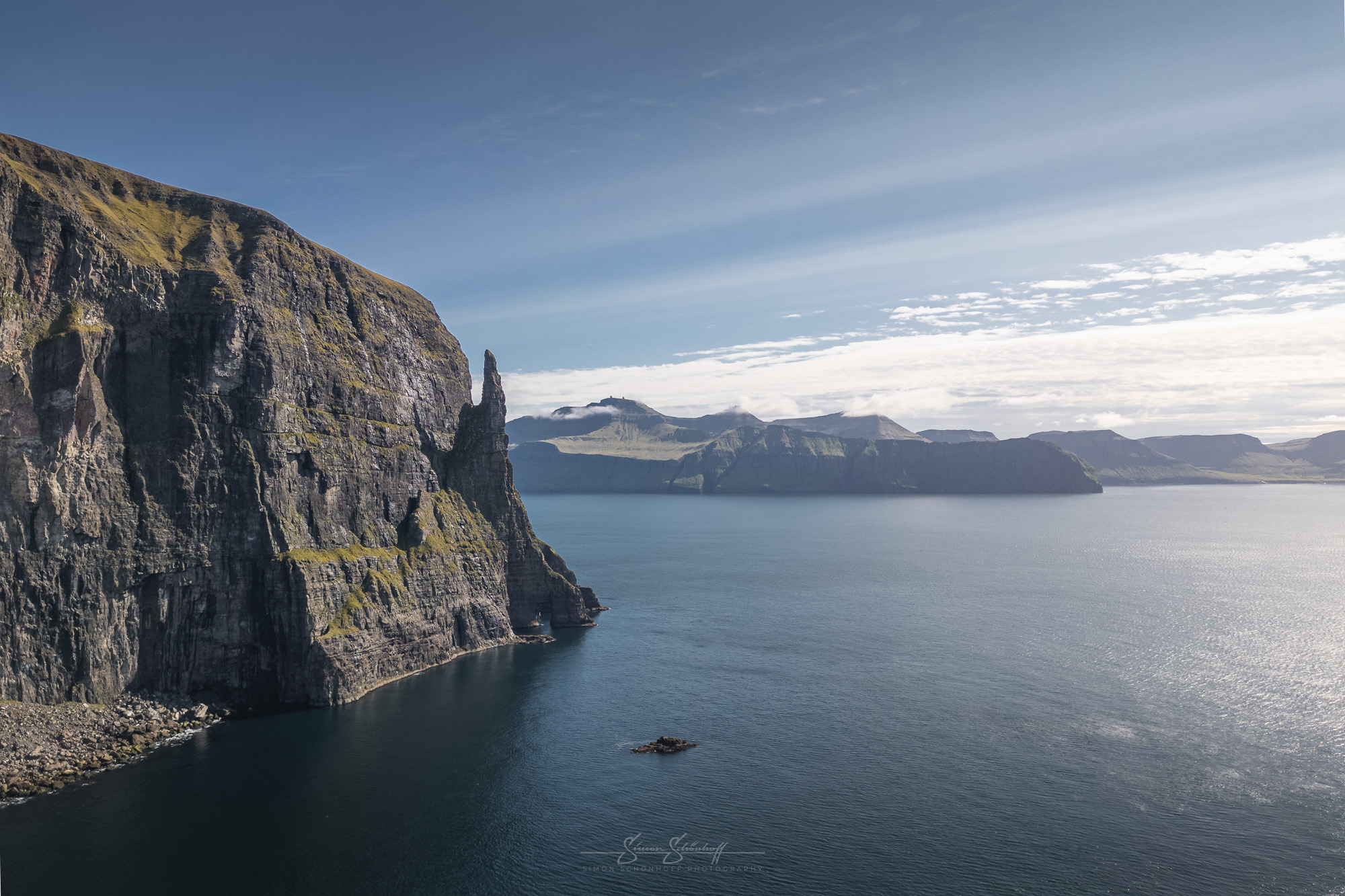
However, we still had a little time before our ferry to Mykines departed. Even though we knew it wouldn’t be the ideal time of day for it, we headed to a nearby spot, the witch’s finger: Trøllkonufingur. Literally translated, this means troll’s finger.
It’s about a 20-minute walk from the car park. On the way you will pass a beautiful house, which you can use as a wonderful foreground in better light than we had (early morning or evening) to photograph it with the island of Koltur in the background.
To get a slightly better direction of light, I used my drone and flew as far out to sea as made sense from the angle, so that the finger and the mountain were still separated. For another picture I was lucky that a ship sailed past the finger, which also adds size to the picture, as you can see how high this finger actually is.
Incidentally, you also have a beautiful view from the hike to Trælanípa. You can see the picture in the first part of this series on day 2.
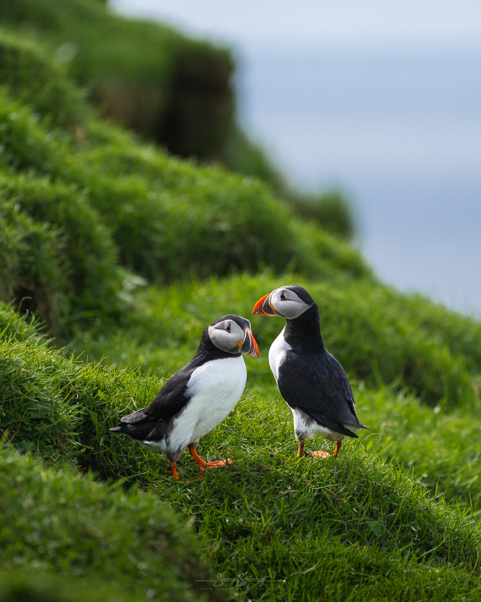
In the afternoon, we travelled to Mykines, the westernmost island of the Faroe Islands. It can only be reached by helicopter or ferry from Sørvágur. It is considered the home of the puffins on the Faroe Islands. The trip out to the island is definitely a highlight. In good weather, you pass close to Drangarnir. But the coastline along the south coast of Mykines is also very impressive and is somewhat reminiscent of the coastline of Hawaii.
However, when we arrived on site, a nuisance began that we didn’t have on our radar. We were practically forced to book a guided tour for no less than DKK 500 (!) per person. Only the place itself is free. This means that the fee has more than doubled in the last two years. Anyone who thinks they are getting more for their money is mistaken. The hiking route to the lighthouse is now closed and will probably no longer be open to tourists. In other words, for just under €70, you get a short tour of the village, a few scanty details about puffins and a guide to accompany you on the walk up the slope. Once you reach the puffins at the top, you’re lucky if you see any puffins at all due to the size of the group and the guide only serves as a watchdog to make sure you don’t leave the path.
I understand the locals. They want to make sure that no nests (burrows) of the puffins are trampled on. You can believe that or not. But nevertheless, at first glance it seems as if the locals have simply agreed to fleece the tourists and introduced the obligation to “guide” them. In any case, a bitter aftertaste remains.
At least we were able to achieve our daily goal of observing, filming and photographing puffins. If we hadn’t seen any for the money, it would have been even more annoying. We spent the afternoon on site. When the guide realised that we were really interested in the photos, that we were very familiar with the puffins and that we would abide by all the rules, she even left us alone. So we had plenty of time to film and take photos. Later, I also photographed some nice details in the harbour while waiting for the ferry. There was a real spectacle of seagulls between large rocks.
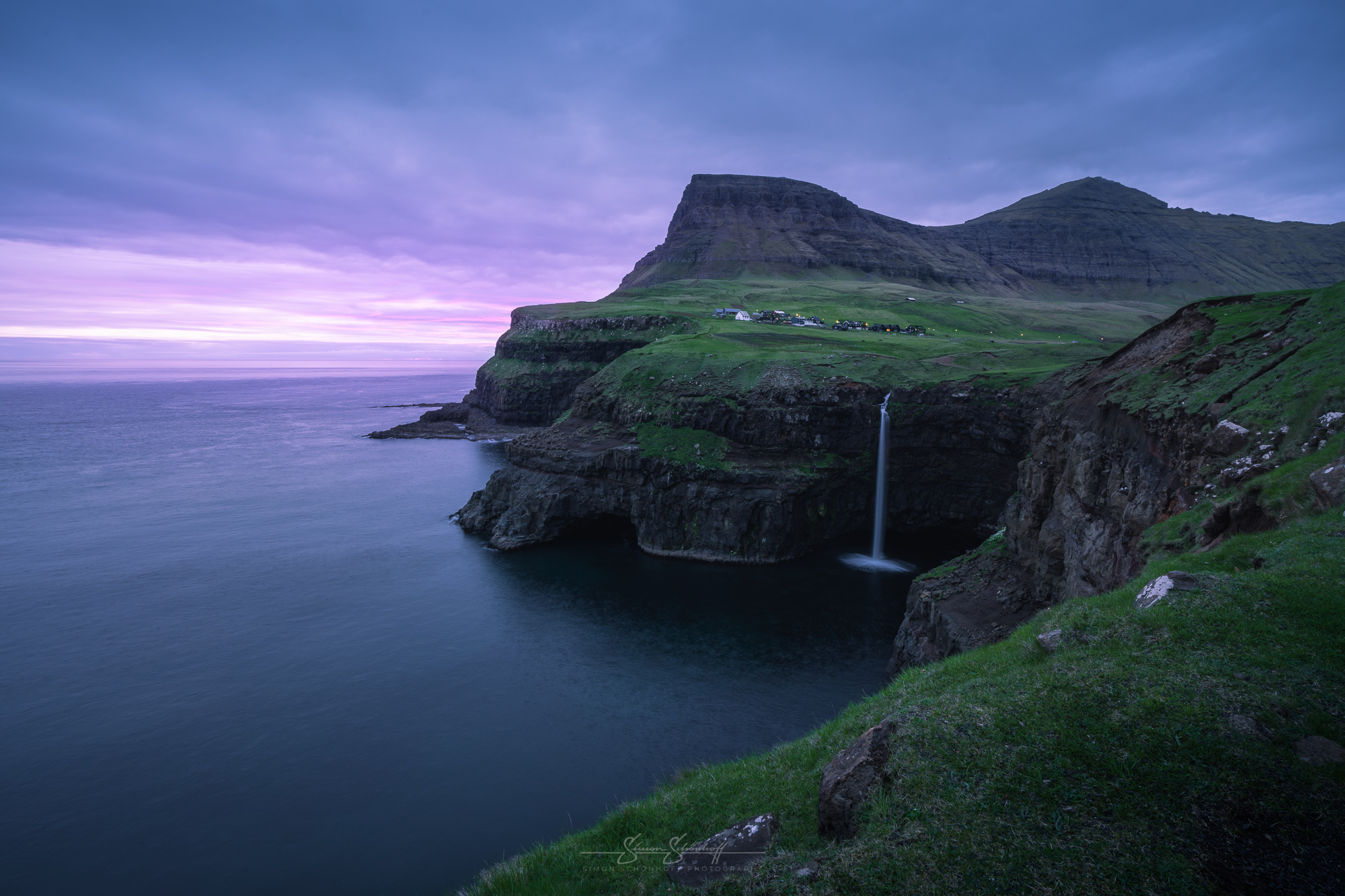
Once we were back and could look past the annoyance, I checked the weather again for the evening. Lo and behold, something had changed. The Viewfindr app now even showed a 50:50 chance of a sunset at Gásadalur. So we shouldn’t miss the chance. So we drove to Gásadalur, but this time directly without a stopover.
We met our fellow photographers from Italy again on site. We told them about Mykines and our annoyance at the further increase in the fee to DKK 500. He understood our anger, but emphasised that we didn’t have to go to Mykines because of the puffins, as he had seen some at the waterfall earlier. So we stopped by the waterfall again and found a whole family of perhaps 12 puffins. That evening I took lots more pictures of these cute feathered friends.
I also made what felt like hundreds of attempts to capture details of Múlafossur in calm conditions. I managed to get some great shots. Once with a puffin that flew very close to the waterfall and some shots with seagulls that look really spectacular. The sky over Gásadalur remained lifeless for quite a long time, which is why I had plenty of time for such shots. But then suddenly some colour came through on the horizon. We hoped it would grow a little more, but this small local sunset only lasted a few minutes and then the colour and light were completely gone. So we said goodbye and drove back to our accommodation.
As always, the morning routine included checking the weather forecast. On the programme for the Faroe Islands today: low cloud, but at a reasonable height, rain possible in places. There was a good chance of seeing a few fjord viewpoints that we had already visited on our way past during the day, but visibility was around zero. The underside of the clouds should also be suitable for the famous Snake Road and a few nice shots of it.
And so it was. The weather was fine, the clouds were nice and low, sometimes it drizzled a little, but we could see everything we wanted. We slowly got to grips with the weather on the Faroe Islands and were able to better assess what it would look like at the individual locations.
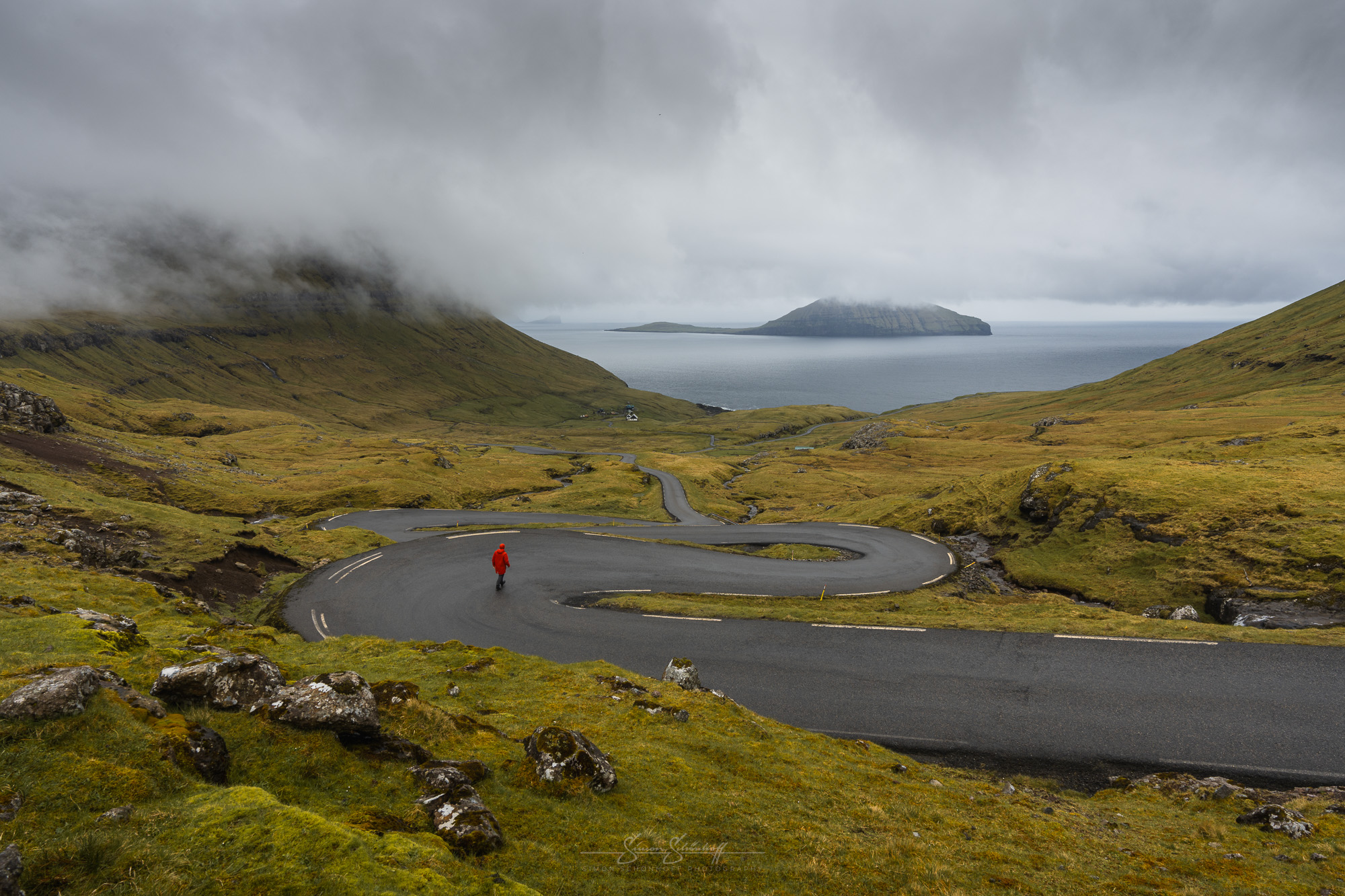
The plan for the afternoon/evening had already been made. The Faroe Islands should be covered with clouds in the centre, but the sky should be clear to the north-west, which should make for a beautiful sunset at Kallur lighthouse. It was to be a highlight of our trip.
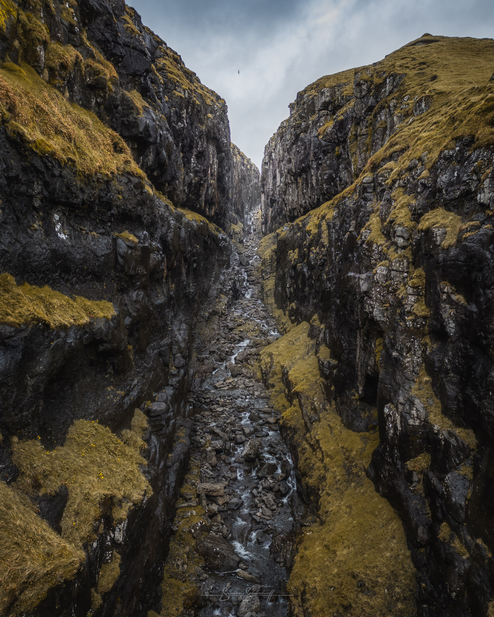
We set off in the afternoon and drove towards Klaksvik. On the way, we stopped again briefly at a spot we had already discovered the day before. A “small” crevice in the middle of a hill on Vágar. I launched the drone and manoeuvred it into the crevice. One shot in and one shot out should be enough. Then carefully fly out of the narrow crevice again and continue on our journey to Klaksvik, from where our ferry was due to leave in the early evening.
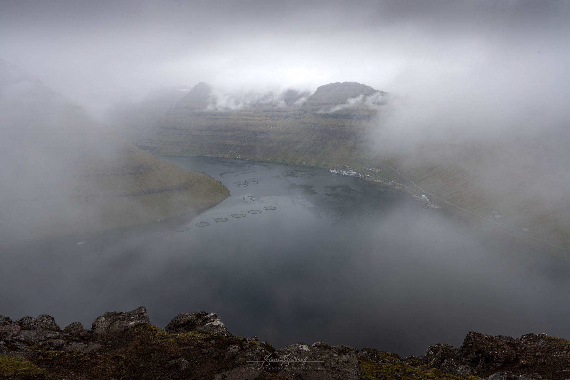
But first we wanted to enjoy the view from Klakkur. A short hike of about 45 minutes leads up to Klakkur. The climb is easy to master if you are in average physical condition. From there you have a wonderful view of Kalsoy (left), Kunoy (centre) and Bordoy (right). We struggled a little with the time and the weather. We knew that the clouds in the centre of the islands could throw a spanner in the works. As our ferry was due to leave soon, we couldn’t wait too long.
The summit was in the clouds at times when we were there. Sometimes we had a good view of the fjords for a short time, but before we could look for ideal compositions, we were usually shrouded in fog again. However, it is definitely a great, rewarding viewpoint when the clouds aren’t too low.
So we set off again in the direction of Klaksvik and the ferry. It’s important to mention that you should book the ferry online in advance. Car parking spaces are very limited. Some journeys can only be booked by telephone. The number can be found on the website of the online booking system. An uncomplicated phone call and a few minutes later the activation, so that we could book.
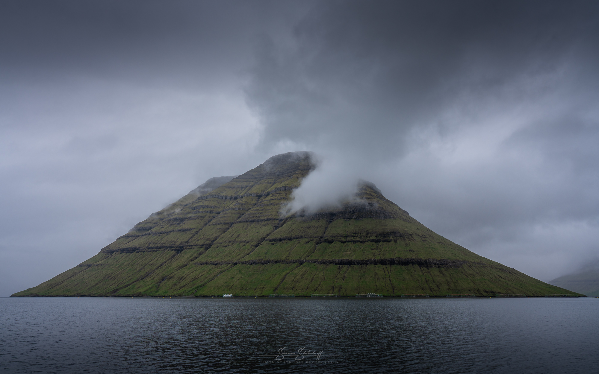
We bought some refreshments and as we still had a few minutes, we watched a football match in Klaksvik in front of an impressive fjord backdrop. We passed the waiting time quite nicely and then boarded the ferry. The ferry takes you past the island of Kunoy into the other arm of the fjord and heads straight for Syðradalur on the island of Kalsoy. You can’t really get lost on Kalsoy itself. There is only one road from Syðradalur to Trøllanes. On the way up north, you drive through a total of four dark, sparsely lit tunnels. The journey is already beautiful, because you can see the remoteness of this island.
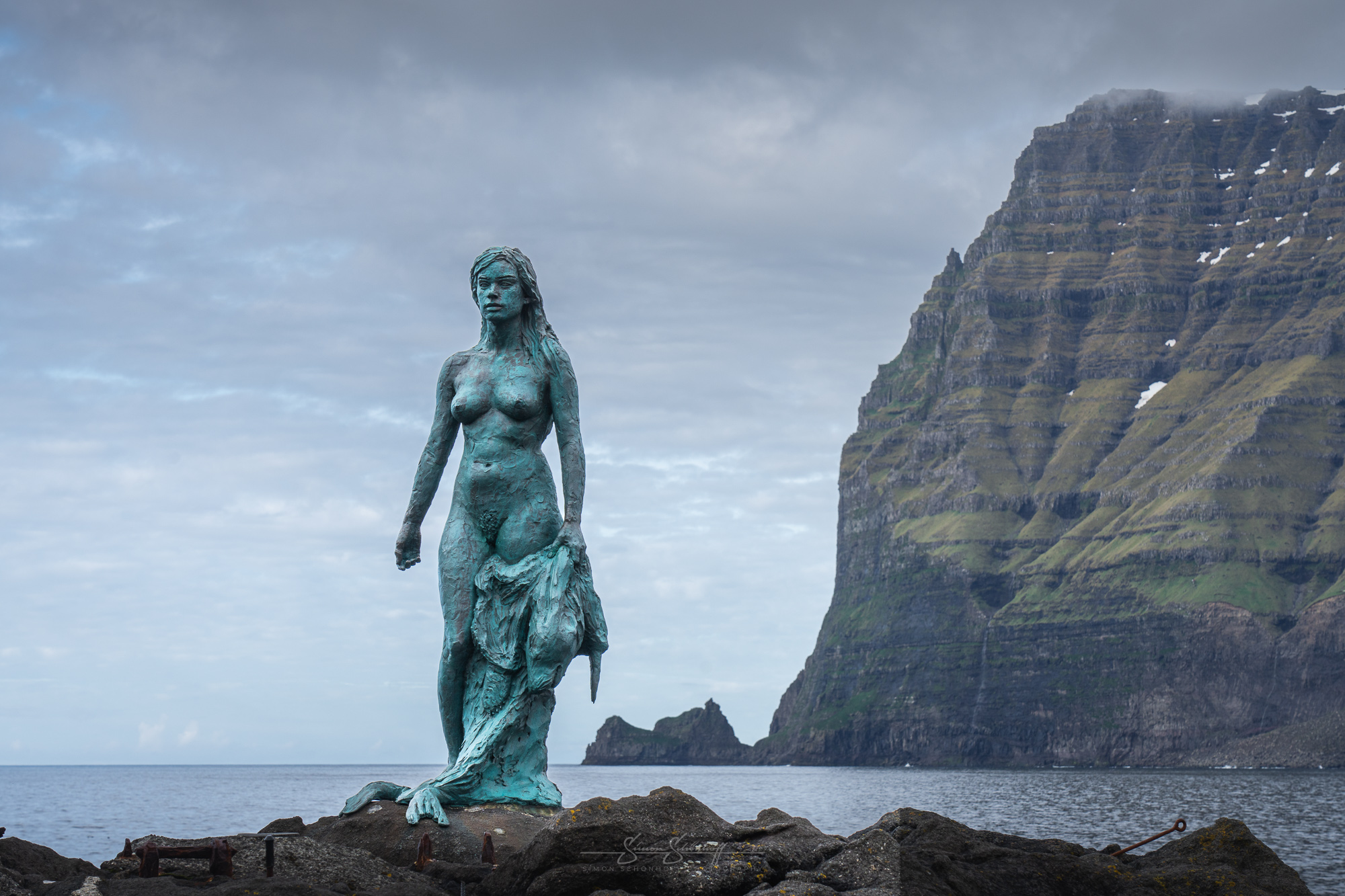
We drove past Husar to Mikladalur. Once there, we got to know two nice local café owners. Their café is right next to the mermaid, which is actually a seal woman (kopakonan). We had a nice chat. It was about sheep farming, agriculture and how life on the Faroe Islands is changing because of tourists. More guided walks, events, tourist bars and cafés, etc. and that tourists are both a curse and a blessing. Nature conservation, environmental protection, erosion, but also GDP, source of income, etc.
The story of the seal woman, by the way, goes back to an old legend. It said that the seals were actually people who sought their death in the sea and went back ashore on certain nights of the year to take off their fur and dance. A farmer stole a pretty woman’s fur to take her as his wife. Long-story-short, it was a pretty unsuccessful love story, she escaped, he went seal hunting and killed her family, and the rather one-sided romance ended with the seal woman returning as a troll and cursing him and all the men of Kalsoy. They were to fall off the cliffs or die at sea until their bones lined the whole of Kalsoy. As men are still dying at sea, the locals believe that the debt has not yet been paid.
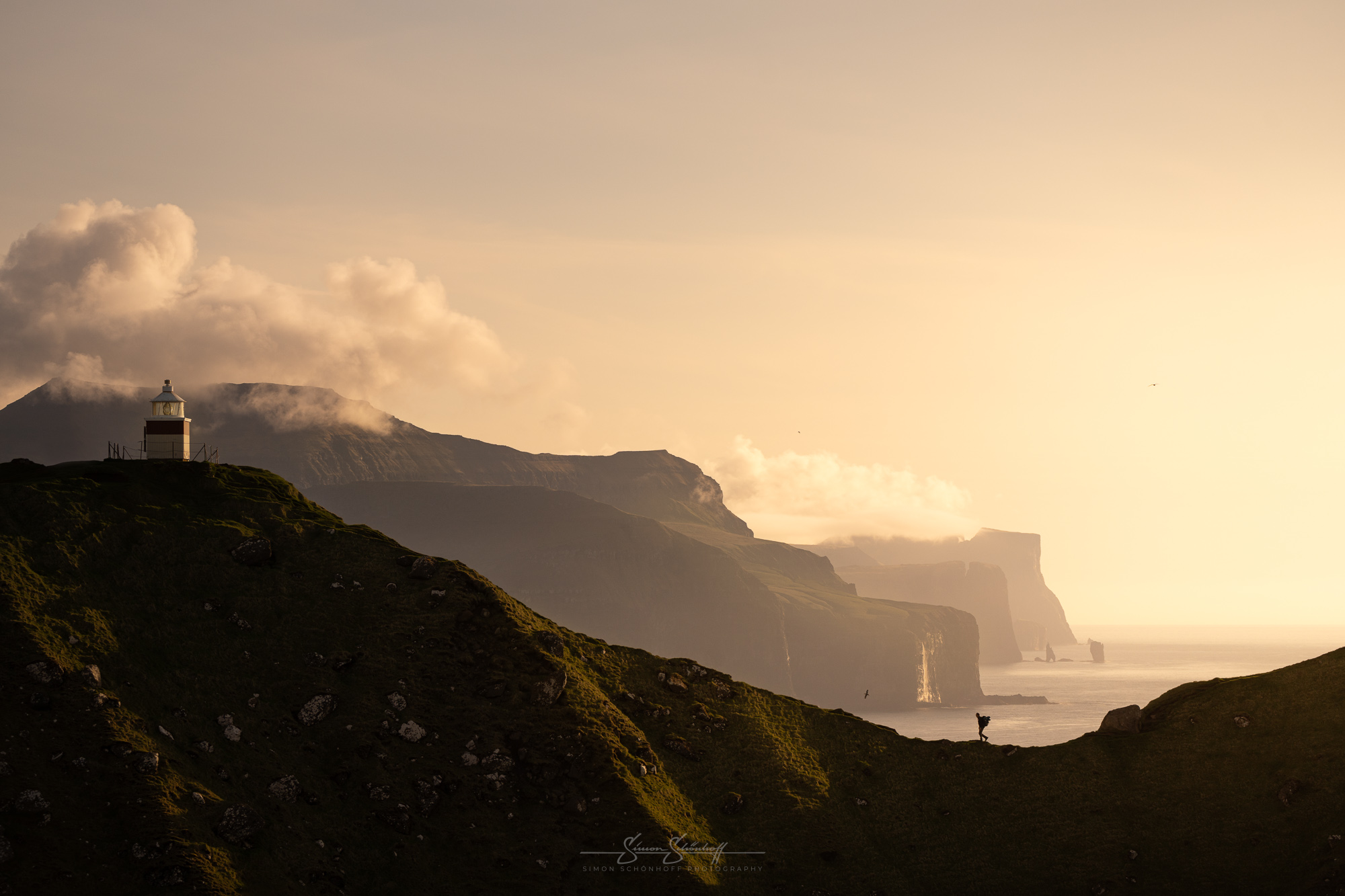
We continued on to Trøllanes, just a few minutes further north. We had got used to the fees by now and paid our DKK 200 per person as a matter of course before setting off towards the lighthouse. The path was actually safe and not too difficult, but the conditions made it a slippery party, slippery wet grass, muddy, trodden path — it could quickly pull your feet away. This made it more strenuous than it should have been. But at least the weather co-operated as planned. The sun came out at just the right time.
We first went to the viewpoint on the eastern ridge. From there you have a fantastic view along the northernmost points of the neighbouring islands. Photographically, wide-angle, standard and telephoto are possible from here. A great scene with an insane, almost crazy scale is created when someone hikes over the edge to the second viewpoint and you take a picture of them with a focal length of approx. 100 mm. As there were no hikers on the way, I sent my father to walk over the edge several times.
Once the pictures were in the can, I went to the second vantage point myself to enjoy the world’s most beautiful view. Photographically, 16mm wide-angle full-frame doesn’t feel wide enough here. If you want to capture everything, you have to take a vertical or horizontal panorama. The drone also has to fly far, far away or use a panorama to capture this massive backdrop in its entirety. You don’t realise the dimensions, even when you see the little tiny white seagulls flying along the cliffs. We were there for a good 2 hours, enjoying the view, taking photos, filming and marvelling. A moment that you wish you could capture forever. A photograph can do that, at least in part, it’s simply amazing.
The last ferry took us back to Klaksvik, just 1 hour and 10 minutes later we were back at our flat. Grateful for what we had seen, a special moment for the soul. This world is big, unique and wonderful. What a blessing that we were able and allowed to experience it for ourselves.
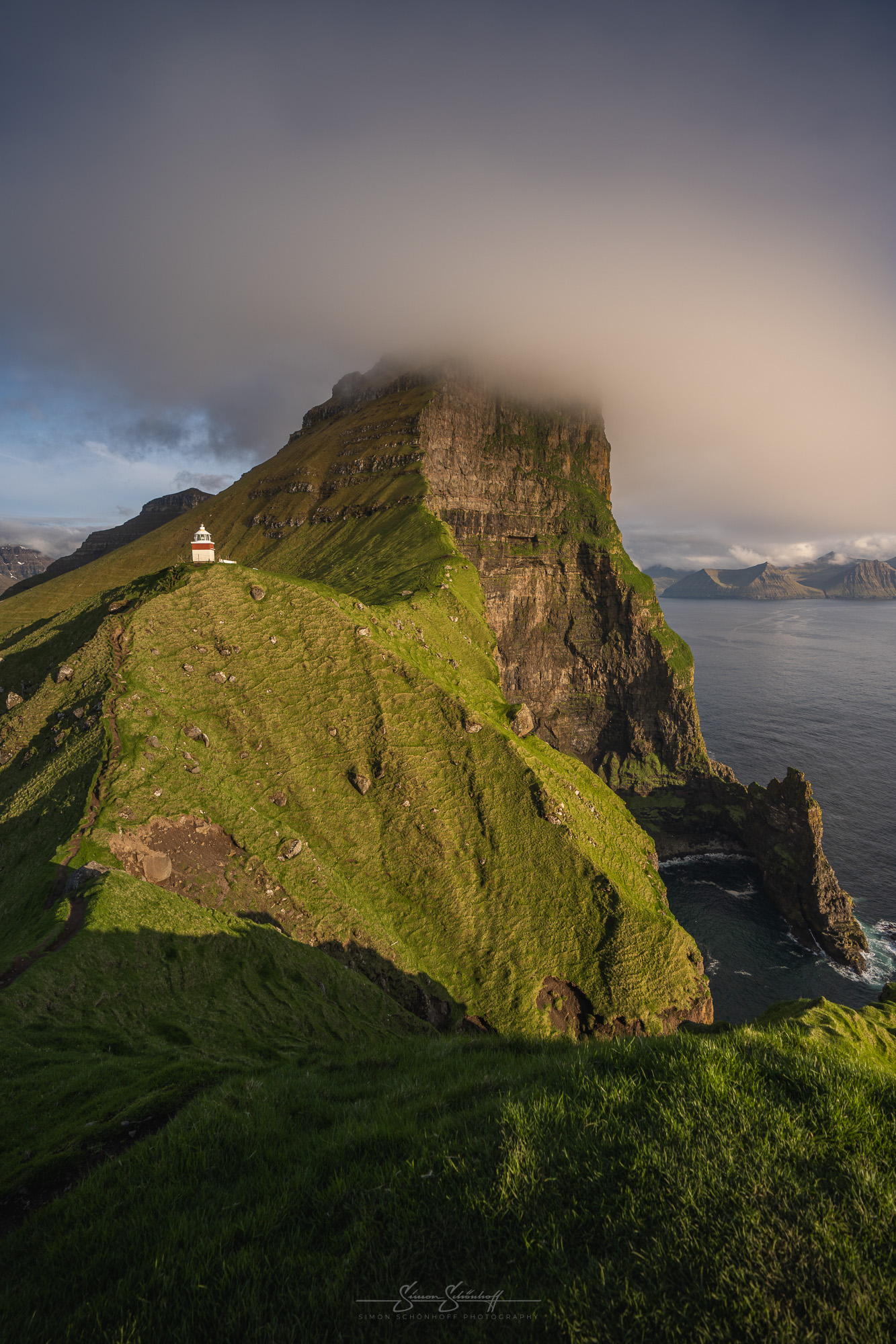
For the next day — the last day on the Faroe Islands — we had decided on a hike to Drangarnir. It is also an impressive natural monument that can only be reached on a guided tour. The cost is not cheap. About 80€ converted. For this you get a little information about the place itself, a hike lasting 5–6 hours and a distance of around 12 kilometres. An alternative is a boat tour to the end of the headland. This is only slightly more expensive and is a good option for those who are not free from vertigo or are not good at walking.
The path is a little more challenging at the start, very narrow and slippery in places. On the right, it goes straight down into the water, on the left it climbs steeply up the slope. Once you have completed the first 20 minutes, however, the most challenging part is already over. You pass old houses or their ruins, a pebble beach, a waterfall and fenced-in meadows. The ascent to the upper vantage point is sweat-inducing. The guide took a break with us there so that we had time to take photos. The motif was Drangarnir from a distance. Photo tip: look for a foreground here too and go for a slightly wider angle. I had the feeling that telephoto shots are not particularly interesting here. Unless you can find suitable “distractors”.
The last few metres, the descent to Drangarnir, is then less demanding, although you should still take care. You also have plenty of time to take photos directly at Drangarnir. Due to the many people on the hike, this time was also necessary. There was always someone standing or walking in front of the lens. This could be remedied by composing several shots in Photoshop or using a long exposure to “eliminate” people. When most people were already heading back, I had another perfect opportunity. Photo tip: A person in the foreground is certainly interesting, take the cliff ridge as the foreground, or position a person at the end of the cliff to visualise the size of the rock.
Further down, if the swell allows it, photography at water level is possible. Flying drones is only permitted here with the owner’s permission, especially during the breeding season. The way back is a little less strenuous as you walk further down along the fjord and not via the upper viewpoint. However, the last half is the same.
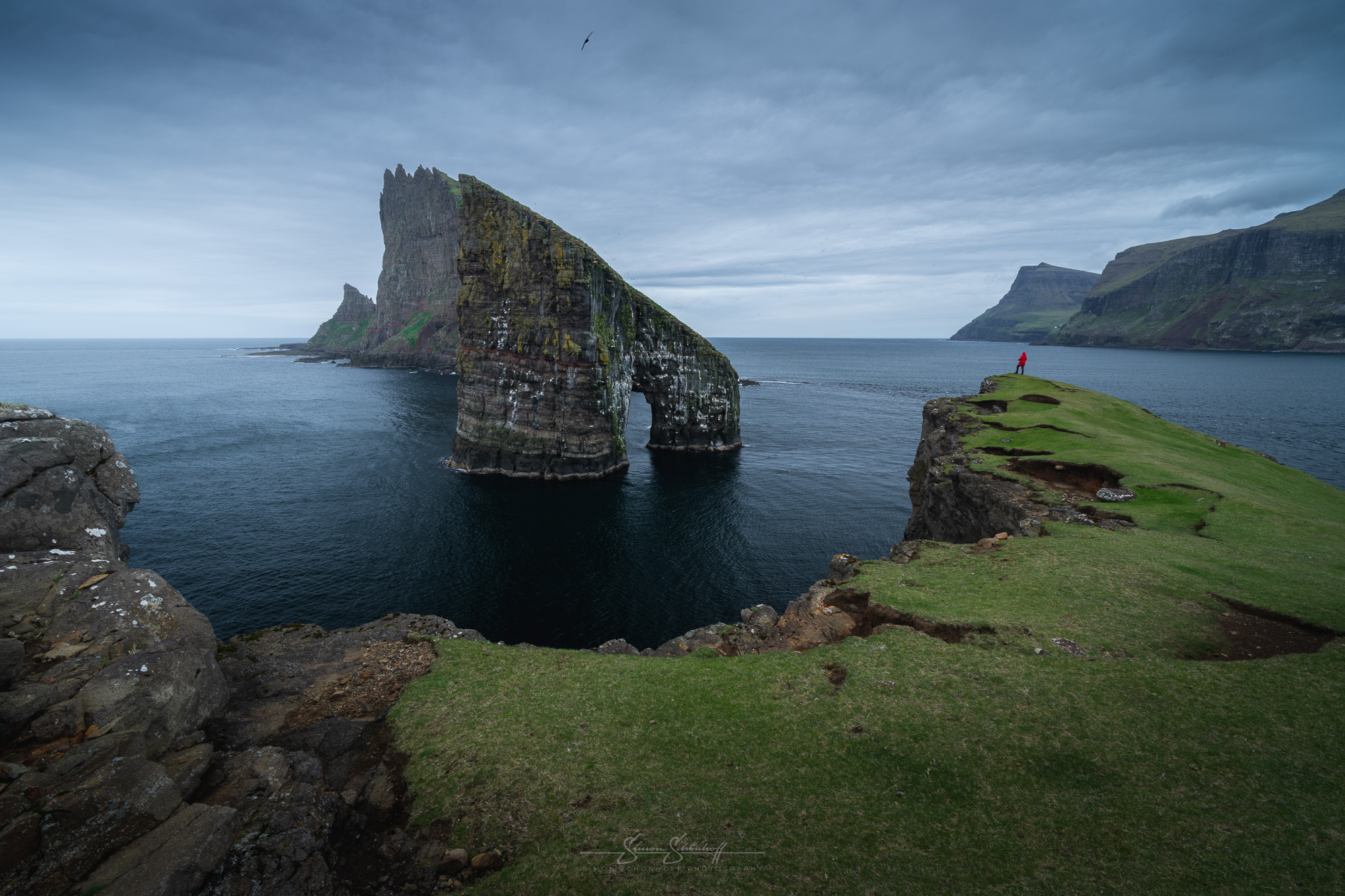
The trip to the Faroe Islands was a sensational experience. A great trip, a beautiful, impressive country with magnificent landscapes. The Faroe Islands are certainly not everyone’s cup of tea. The weather is a bit of a lottery. But there is hardly any other country that looks so brilliant in pictures in “lousy” weather. Mykines is well worth a visit, but you can also find puffins elsewhere if you are observant and don’t mind paying for a guided tour.
Faroe Islands — a country where tourism is still in its infancy. You can see that in many places. Nature conservation is very important to the Faroese in large parts, but I don’t think they really know how to go about protecting nature while still allowing tourism. Simply charging more and more fees in the hope that fewer people will visit is not enough to protect the environment. Perhaps the state needs to become more active here and not rely on the landowners alone. The protection of their land is also important to them, but so is a full wallet.
The Faroe Islands are definitely worth a trip for photographers and hiking enthusiasts. But don’t underestimate the dimensions and the weather. Also note that there isn’t always a refuge like in the Alps, so you’ll be safe on the road!
I hope I was able to give you some inspiration, information and enthusiasm in the 3 parts about the Faroe Islands. Thank you for reading/watching! Take care. Ciao!
This and all other shots of this post you can request under “Prints” as an art print for your wall at home directly from me.
Today is the third and final part of my trip to the Faroe Islands. In today’s video, we visit the cutest inhabitants of the Faroe Islands, take a look at some more unknown spots that are super easy to reach, I show you a moderately difficult hike with great views, we drive through Klaksvík and hike to two of the absolute highlights of the Faroe Islands. Plus, here are a few things you should know before you go hiking on the Faroe Islands! And at the end, a short summary of the Faroe Islands. Have fun watching!
Feel free to share: